Escape From the Prison Planet
- Thread starter DRIVEN
- Start date
You are using an out of date browser. It may not display this or other websites correctly.
You should upgrade or use an alternative browser.
You should upgrade or use an alternative browser.
- Status
- Not open for further replies.
Just haven't gotten that far yet. Trying to hype the anticipation.
I needed to retest my luggage on the white bike after the reinforcement and the new Borat system. I left yesterday about 11 and started the day with a taco stop then a few miles of gravel road. The next several miles were decent 2 track through the desert. With all the camping gear, the bike does okay until it gets complicated with steep hills or deep moguls. This hillclimb was a lot steeper than it looks.

As I climbed in elevation the trails got a little, then a lot rougher. On the rocky and steep stuff I discovered that all that weight out back really had an adverse effect on maneuverability. Even with only 14hp, it really wanted to climb. That fat tire wants to grab and push. The problem is that all that weight on the rear makes the front light and hard to direct. Basically, it's a directed wheelie situation unless I'm up on the pegs.
I saw several cabins and a few mines.

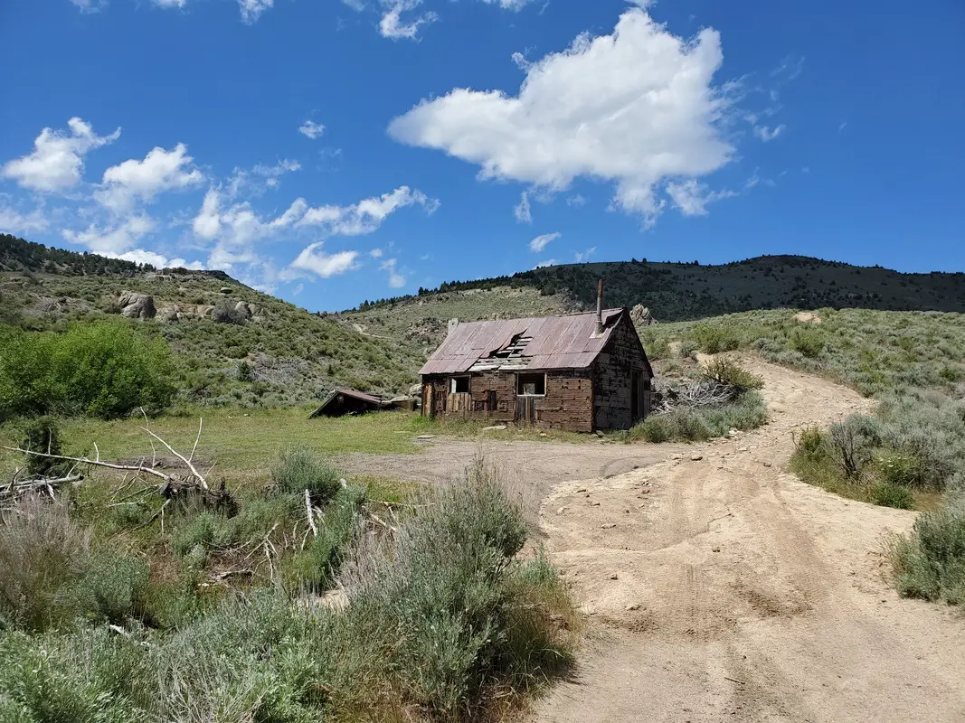
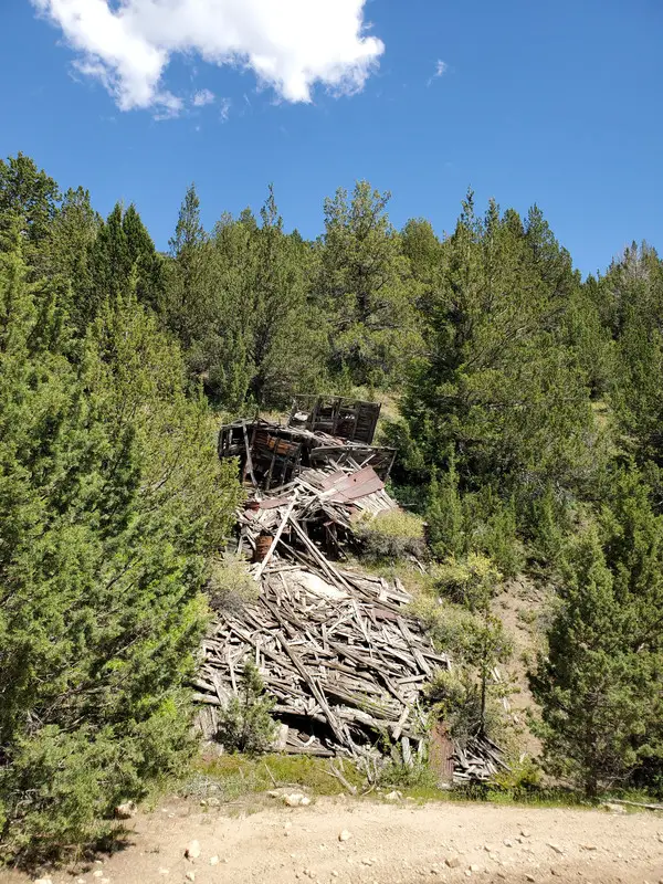

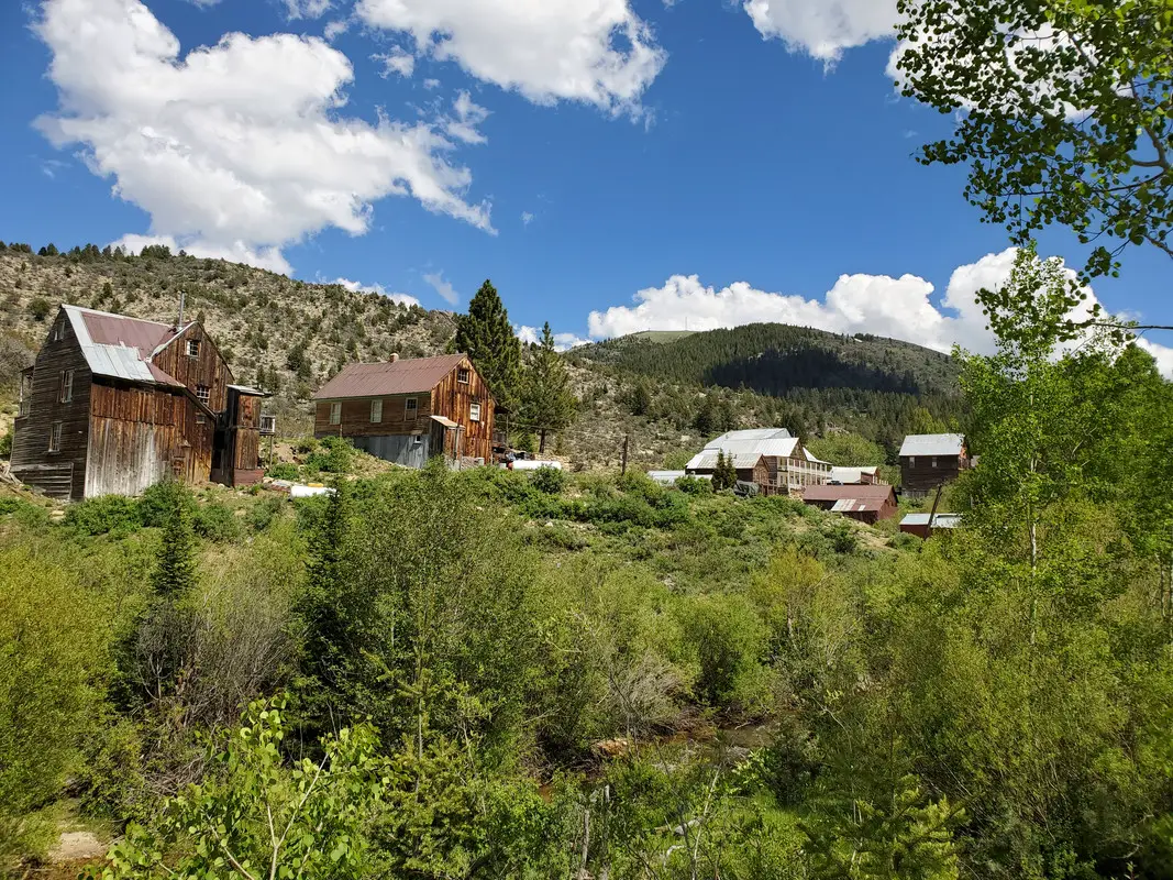
I kept climbing to 8002 feet then dropped into the back side of Silver City.


I've been using OnX Offroad for my routing and ran into a glitch or two so far. But this one was pretty inconvenient. Once I left Silver City I was headed to Reynolds and a few miles beyond to where I planned to camp. OnX made no designation to Reynolds Creek road crossing private property and being closed. I passed a sign and shrugged it off until I got to a padlocked gate and turned around. I was going over Black Mountain to bypass and saw a trail on the map that looked like it bypassed the private land. Actually, it was 2 parallel trails. I followed the first but it obviously hadn't been used in a long time. It was a couple miles long and dead-ended at another padlocked gate.

I had to backtrack about a mile to where it looked like I could overland to the parallel trail. Well, after a couple hundred yards it dropped me into a dry creekbed. Looked like a road on the map though. I could see where I was trying to go so I just followed it. Literally 1-2 mph over rocks and sagebrush. I eventually ended up where it looked like maybe there had once been a "road". Maybe.
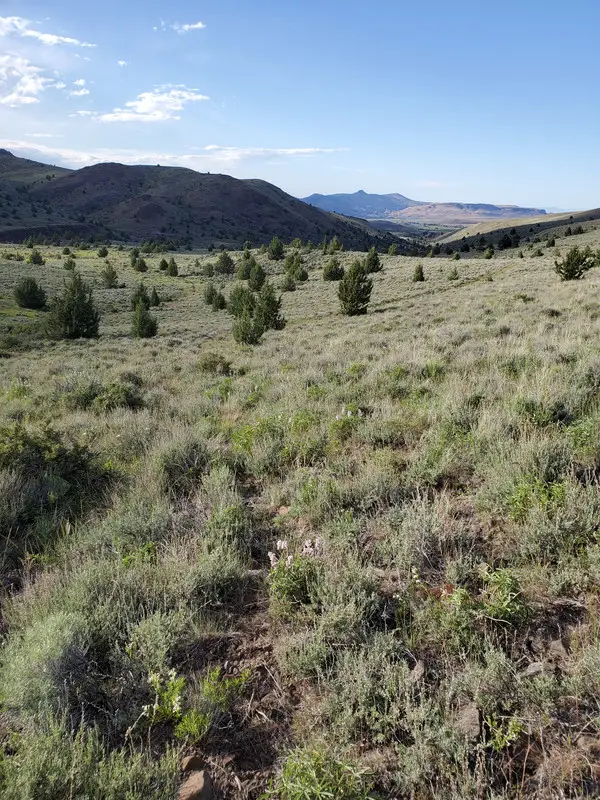
I followed it another 1/2 mile until I got down to where cattle had been. At one point I got tangled with a sagebrush trunk the size of my forearm and I had to use a hatchet to free the TW. About 100 yards after that I had a 12-16" water crossing to finally get to Democrat road. I ended up behind another chained rancher's gate. Since it was really close to his house I quietly slipped through and bolted toward Reynolds.
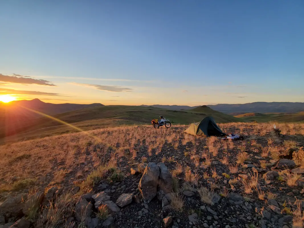
Just a few miles NW of Reynolds I found a spot on top of a hill where I've seen wild horses in the past. It wasn't necessarily a comfortable night but I was all alone and the view was unbeatable. Sunrise, especially.

As I climbed in elevation the trails got a little, then a lot rougher. On the rocky and steep stuff I discovered that all that weight out back really had an adverse effect on maneuverability. Even with only 14hp, it really wanted to climb. That fat tire wants to grab and push. The problem is that all that weight on the rear makes the front light and hard to direct. Basically, it's a directed wheelie situation unless I'm up on the pegs.
I saw several cabins and a few mines.


I kept climbing to 8002 feet then dropped into the back side of Silver City.


I've been using OnX Offroad for my routing and ran into a glitch or two so far. But this one was pretty inconvenient. Once I left Silver City I was headed to Reynolds and a few miles beyond to where I planned to camp. OnX made no designation to Reynolds Creek road crossing private property and being closed. I passed a sign and shrugged it off until I got to a padlocked gate and turned around. I was going over Black Mountain to bypass and saw a trail on the map that looked like it bypassed the private land. Actually, it was 2 parallel trails. I followed the first but it obviously hadn't been used in a long time. It was a couple miles long and dead-ended at another padlocked gate.

I had to backtrack about a mile to where it looked like I could overland to the parallel trail. Well, after a couple hundred yards it dropped me into a dry creekbed. Looked like a road on the map though. I could see where I was trying to go so I just followed it. Literally 1-2 mph over rocks and sagebrush. I eventually ended up where it looked like maybe there had once been a "road". Maybe.

I followed it another 1/2 mile until I got down to where cattle had been. At one point I got tangled with a sagebrush trunk the size of my forearm and I had to use a hatchet to free the TW. About 100 yards after that I had a 12-16" water crossing to finally get to Democrat road. I ended up behind another chained rancher's gate. Since it was really close to his house I quietly slipped through and bolted toward Reynolds.
Just a few miles NW of Reynolds I found a spot on top of a hill where I've seen wild horses in the past. It wasn't necessarily a comfortable night but I was all alone and the view was unbeatable. Sunrise, especially.

This is probably kind of an odd sidetrack. I've got an bit of an odd fascination with old cemeteries. The first one I stopped at was the one right on the edge of Silver City. The oldest headstone I found was 1874. Most were in the 1890s but I saw one from 1984.

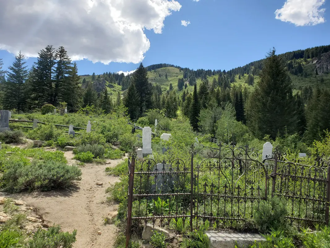
There was a fence that separated the Mason cemetary up the hill. The most ornate headstones were up there but, oddly, so were the most "Unknown" markers. Fire has gone through here several times over the years.

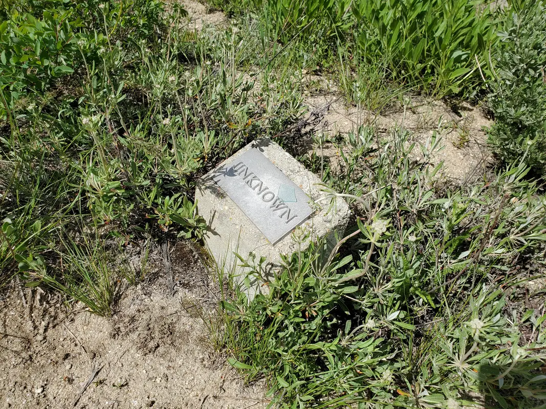
Up the hill from Silver City is the Fairview Cemetary. I only counted 3 actual headstones there. This one had been displaced by the memorial tree and reset in concrete.
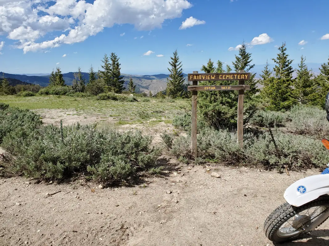

There were about 3 dozen "Unknown" headstones next to placed field stones. I would assume that any less expensive wooden markers were probably consumed by any fires that have come through in the last 150 years.

Life was hard back then. There were lots of baby graves in all of the cemeteries.

It was a long and complicated ride but I made a quick stop in Reynolds. The mosquitoes were relentless. This cemetary looks to be from close to the same time frame. I noted the McDonald family lost 6 children in less than 10 years. Mother died in her 40s. Brutally hard lives.


There was a fence that separated the Mason cemetary up the hill. The most ornate headstones were up there but, oddly, so were the most "Unknown" markers. Fire has gone through here several times over the years.


Up the hill from Silver City is the Fairview Cemetary. I only counted 3 actual headstones there. This one had been displaced by the memorial tree and reset in concrete.


There were about 3 dozen "Unknown" headstones next to placed field stones. I would assume that any less expensive wooden markers were probably consumed by any fires that have come through in the last 150 years.

Life was hard back then. There were lots of baby graves in all of the cemeteries.

It was a long and complicated ride but I made a quick stop in Reynolds. The mosquitoes were relentless. This cemetary looks to be from close to the same time frame. I noted the McDonald family lost 6 children in less than 10 years. Mother died in her 40s. Brutally hard lives.

Out at Reynolds Creek my son and I got down what was a two track that a couple really high powered UTV goons must have made a couple years before and we couldn't climb back out. I fought his bike trying to get it back up the hill, tried the extreme Enduro side hill technique but it was so steep and with large rocks loosely placed in smaller rocks it would bounce and buck me off a line. When it stalled I couldn't use the kick starter because it was basically up against the hillside. We ended up going down through a very steep rocky canyon an then had to sidehill around where it turned vertical. Took more than two hours, it was in the high 80s temperature wise. We both had on 2 gallon water packs that were dry by the time we made it back to the truck.
Easy to get into a pretty ugly situation out there, especially by yourself. Be careful.
Easy to get into a pretty ugly situation out there, especially by yourself. Be careful.
Roger that. That last section wasn't really all that steep, just lots of sagebrush and basketball sized rocks made for really slow going. Literally less than 2mph. I could see the road I was trying to get to in the distance but kept running into locked gates. If I had to turn around and go back it would have taken at least twice as long to get back up the hill. Since it was getting pretty late in the day, I just decided to press on.
You're 100% right about risk of getting ugly. I ride pretty conservatively by myself because there are times where I know if I got hurt or broke the bike it could really be bad. Hell, my campsite wasn't even visible from any road or trail and I did a couple hundred yards overland to get there. If I died in my sleep it would be a long time before anyone found my corpse. There's a lot of seldom/never traveled country out there even though it really isn't too far from civilization.
You're 100% right about risk of getting ugly. I ride pretty conservatively by myself because there are times where I know if I got hurt or broke the bike it could really be bad. Hell, my campsite wasn't even visible from any road or trail and I did a couple hundred yards overland to get there. If I died in my sleep it would be a long time before anyone found my corpse. There's a lot of seldom/never traveled country out there even though it really isn't too far from civilization.
I ordered up the round boy suspension kit plus a new rear tire and tube. Everything went pretty straightforward.


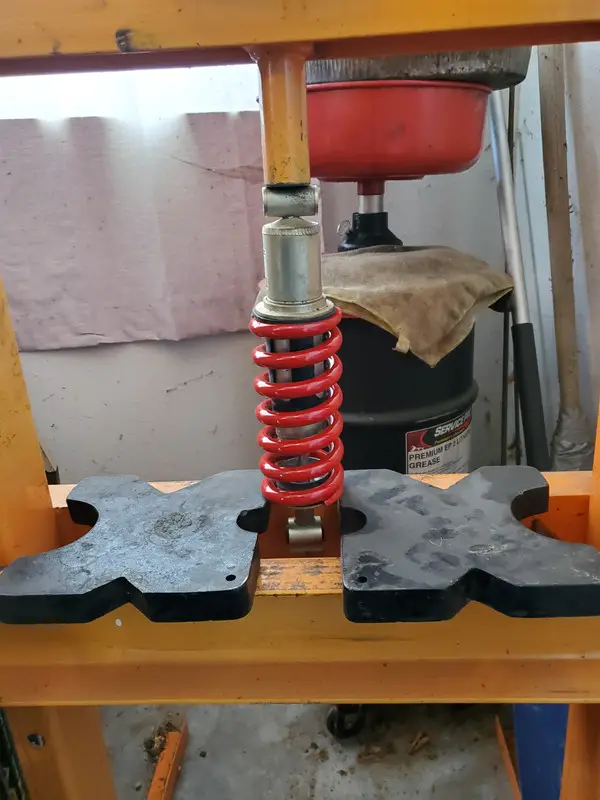

The last ting I did was put in a new air filter. I'm pretty embarrassed that I neglected the old one so badly.

The new stiffer springs were immediately noticeable. I'm anxious to get it out on the trails and see how it handles off road.


The last ting I did was put in a new air filter. I'm pretty embarrassed that I neglected the old one so badly.

The new stiffer springs were immediately noticeable. I'm anxious to get it out on the trails and see how it handles off road.
Stop making me jealous with your nice weather and beautiful scenery.
Those cemeteries are some Jeremiah Johnson type chitt. Just don't cross any sacred Indian burial grounds or you'll be fighting a war with the Crow Indians until you defeat their bravest warriors and they come to respect you.
Those cemeteries are some Jeremiah Johnson type chitt. Just don't cross any sacred Indian burial grounds or you'll be fighting a war with the Crow Indians until you defeat their bravest warriors and they come to respect you.
- Status
- Not open for further replies.
Similar threads
GBodyForum is a participant in the Amazon Services LLC Associates Program, an affiliate advertising program designed to provide a means for sites to earn advertising fees by advertising and linking to amazon.com. Amazon, the Amazon logo, AmazonSupply, and the AmazonSupply logo are trademarks of Amazon.com, Inc. or its affiliates.

